
Ordnance Survey is the home of British mapmaking. Its history dates to 1745, when a twenty-one-year-old engineer was tasked with a small-scale military survey of Scotland. Mapmakers brings to life this illustrious archive in a beautiful book that tells the story of the changing shape of Britain. These are stories of religion, stories of changing industry, stories of politics and infrastructure, and stories of ourselves – where and why we move around this island, and how we do it. We find disappearing footpaths, mutilated maps, secretive smuggling paths and even a a collection of commemorative maps and images for Queen Victoria on her Golden Jubilee, made public here for the first time. The lavish, full-colour volume contains maps from throughout OS’s lifetime as well as specially commissioned graphics showcasing the cutting edge in cartographical technology. Written by award-winning writer, broadcaster and expedition leader Will Millard, this is an unmissable record of how our landscape has changed – and how it might do so in the future.
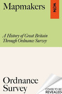
Mapping Britain: The Story of an Island Through the Ordnance Survey Archives
€43.75
Delivery within 7 to 10 days
Book Details
You may also enjoy

The Little Guide to Balenciaga
€8.74

Never Stop Holding Hands and Other Tips for the Adventure of Marriage
€16.24

NKJV, Gift and Award Bible, Leather-Look, Black, Red Letter Edition, Comfort Print
€9.99

The Book of Gifts
€21.24

Ten Poems about Cats [2025] 2nd Edition 2025
€8.69

In Memoriam
€8.69

NKJV Deluxe Gift Bible Red Letter Edition [Pink]
€21.24

The Little Book of Capybara Self-Care
€11.24
Reviews
There are no reviews yet.